Best Sentinel-2 Cloud Mask: SCL vs s2cloudless vs FMask vs Cloud Score+
2026-03-31
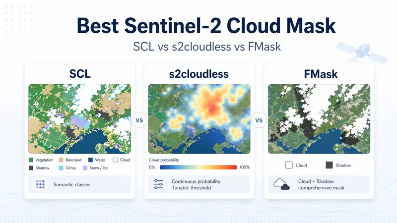
A practical comparison of Sentinel-2 SCL, s2cloudless, FMask, Cloud Score+, and KappaMask for cloud masking, pixel usability, time-series analysis, and quality assurance workflows.