Landsat to Sentinel-2 harmonization
Transform Landsat imagery into Sentinel-2-compatible data for consistent, analysis-ready time series across decades of Earth observation archives.
- Sentinel-2-compatible band layout
- 10 m/pixel harmonized outputs
- Built for long-term change analysis
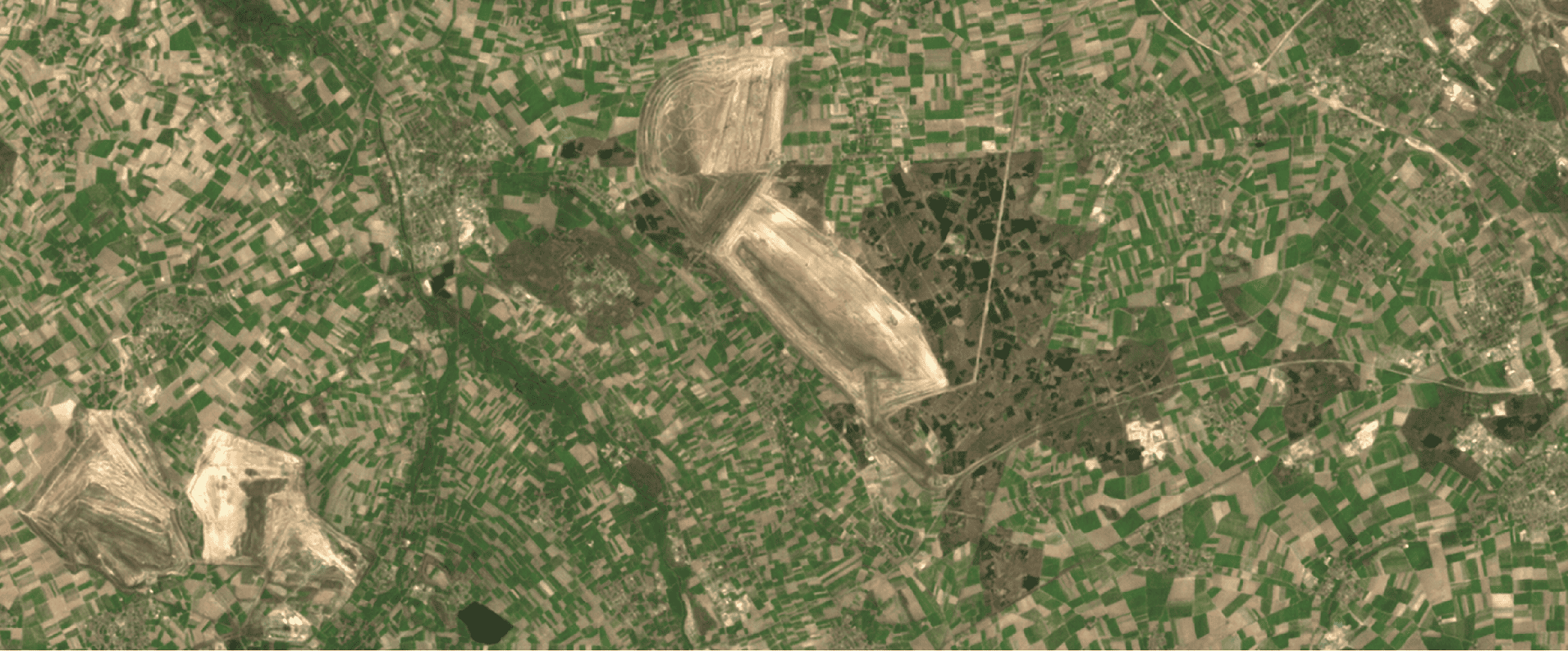
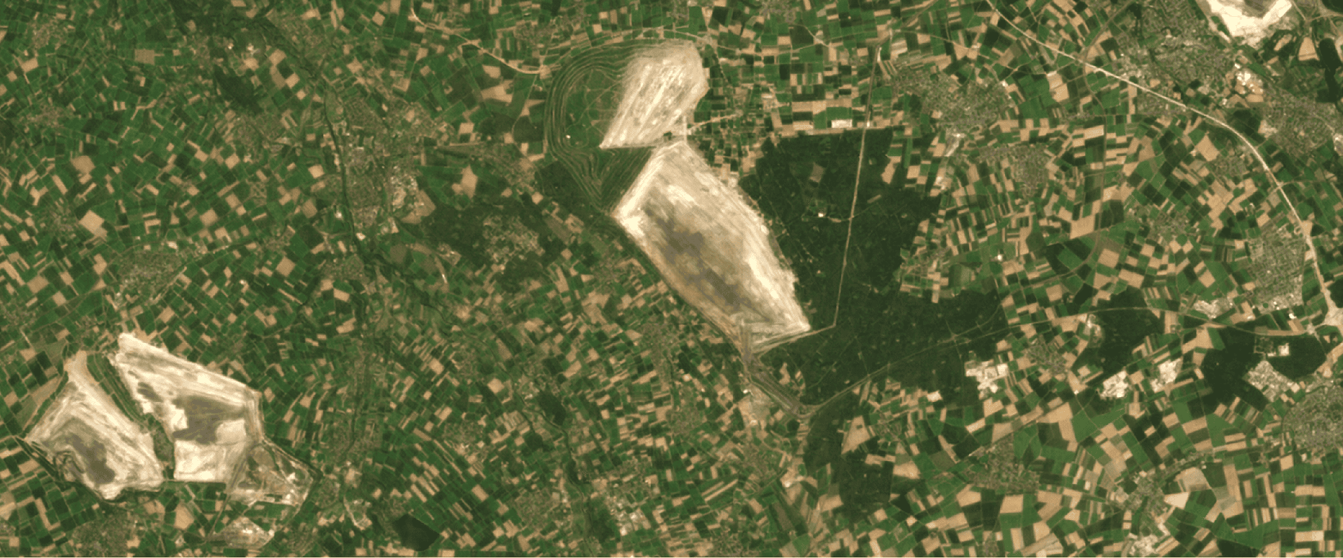
Historical Landsat imagery harmonized into a Sentinel-2-compatible format for consistent time-series analysis.
A consistent historical record
Why harmonization?
Bring decades of Landsat observations into the same working format as current Sentinel-2 imagery, without adding the complexity of a multi-sensor fusion workflow.
Harmonization provides a precise and focused solution for ensuring consistency in Earth observation data without the complexity of multi-sensor data fusion. By aligning Landsat data with Sentinel-2 standards, our service enables seamless integration into workflows while unlocking the value of extensive historical archives.
With decades of Landsat observations, users gain access to a robust temporal record, perfectly suited for long-term trend analysis and environmental monitoring. The standardized data simplifies workflows by eliminating the need for custom adaptations, providing analysis-ready results that save time and resources. Harmonization ensures data uniformity across time and satellite platforms, which is essential for critical applications like land-use monitoring and change detection.
Key benefits
- Seamless compatibility with Sentinel-2 workflows
- Access to Landsat's historical depth
- Simplified workflows with analysis-ready results
Harmonization workflow
Harmonizing Landsat data to match Sentinel-2 involves more than aligning spatial resolutions - it requires addressing differences in spectral bands to ensure compatibility. While many Landsat and Sentinel-2 bands align closely with only minor differences, others present unique challenges due to missing data.
For example, Sentinel-2 includes three red-edge bands (B5, B6, B7) that are absent in Landsat. To harmonize these bands, our models use advanced interpolation techniques that analyze the spectral relationships within Landsat data. By leveraging information from surrounding bands, the model estimates the missing red-edge bands with remarkable accuracy, enabling the harmonized dataset to maintain Sentinel-2's multi-spectral richness.
This process also adjusts for subtle differences between bands that do exist in both datasets, ensuring consistent spectral profiles across the harmonized product. By addressing these gaps and differences, we create a seamless dataset that combines the historical depth of Landsat with the high-resolution capabilities of Sentinel-2, empowering users to make informed, reliable decisions.
Visual evidence
From Landsat input to Sentinel-2-compatible output
Compare the source observation with the harmonized result and inspect the impact of the processing directly.
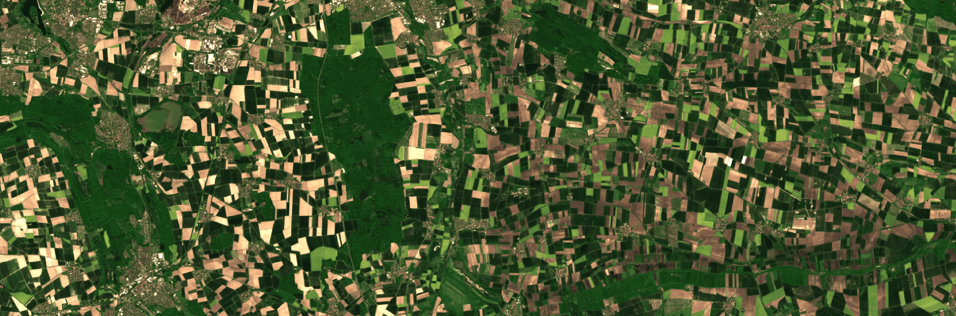
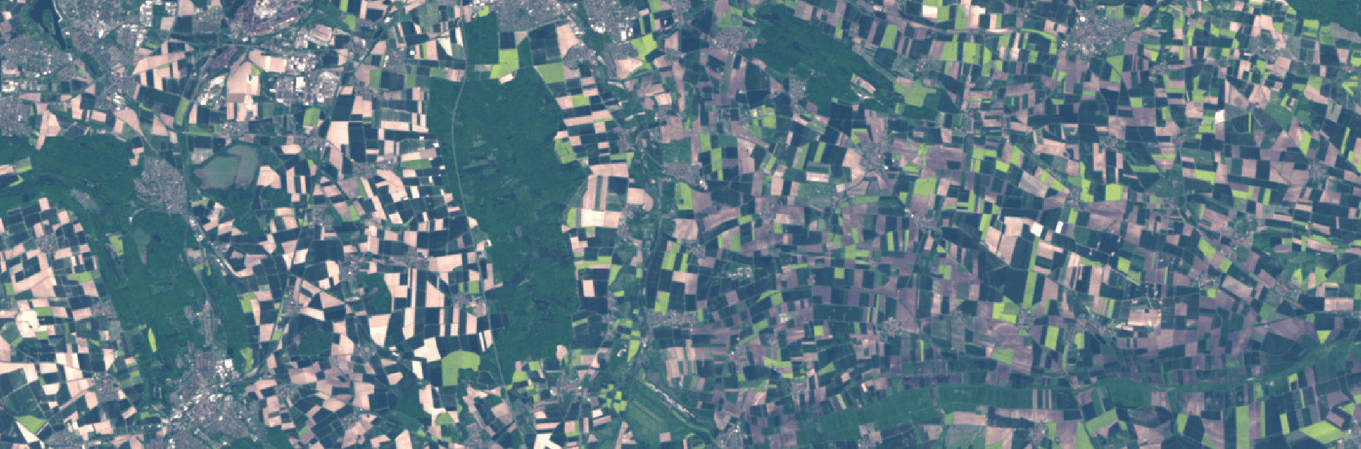
Comparing the before (Landsat Level-1) and after (Sentinel-2 L2A) images to see the impact of our harmonization process.
Technical evidence
Clarity and resolution beyond a format conversion
The processing also addresses atmospheric effects and uses the available panchromatic signal to increase spatial detail.
Removing haze and atmospheric effects
Harmonization doesn't stop at simply matching Sentinel-2 standards. By simulating conditions as if observed under ideal atmospheric conditions, the harmonized data is lightly improved compared to average Sentinel-2 Level-2A (BOA) imagery. This enhancement mitigates the effects of haze and atmospheric distortions, producing data that often exceeds Sentinel-2's typical clarity under real-world conditions.
This capability ensures that users benefit from both the consistency of harmonized data and the clarity of near-perfect observation conditions. The result is a high-quality dataset optimized for applications requiring precision and reliability, such as precision agriculture, land cover classification, and climate monitoring. Moreover, the harmonized data is fully compatible with existing Sentinel-2 workflows, making it an ideal solution for users already relying on Sentinel-2 imagery. By ensuring seamless interoperability with Sentinel-2 datasets, the harmonized product integrates effortlessly into analysis pipelines, offering a consistent and reliable extension to Sentinel-2's capabilities.
Beyond Landsat resolution
Using Landsat panchromatic bands when doing harmonization on Landsat 7 and Landsat 8/9, we increase the resolution acorss all multi-spectral bands. That's how we can deliver 10 m/pixel resolution imagery, when the original imagery is in a 30 m/pixel resolution.
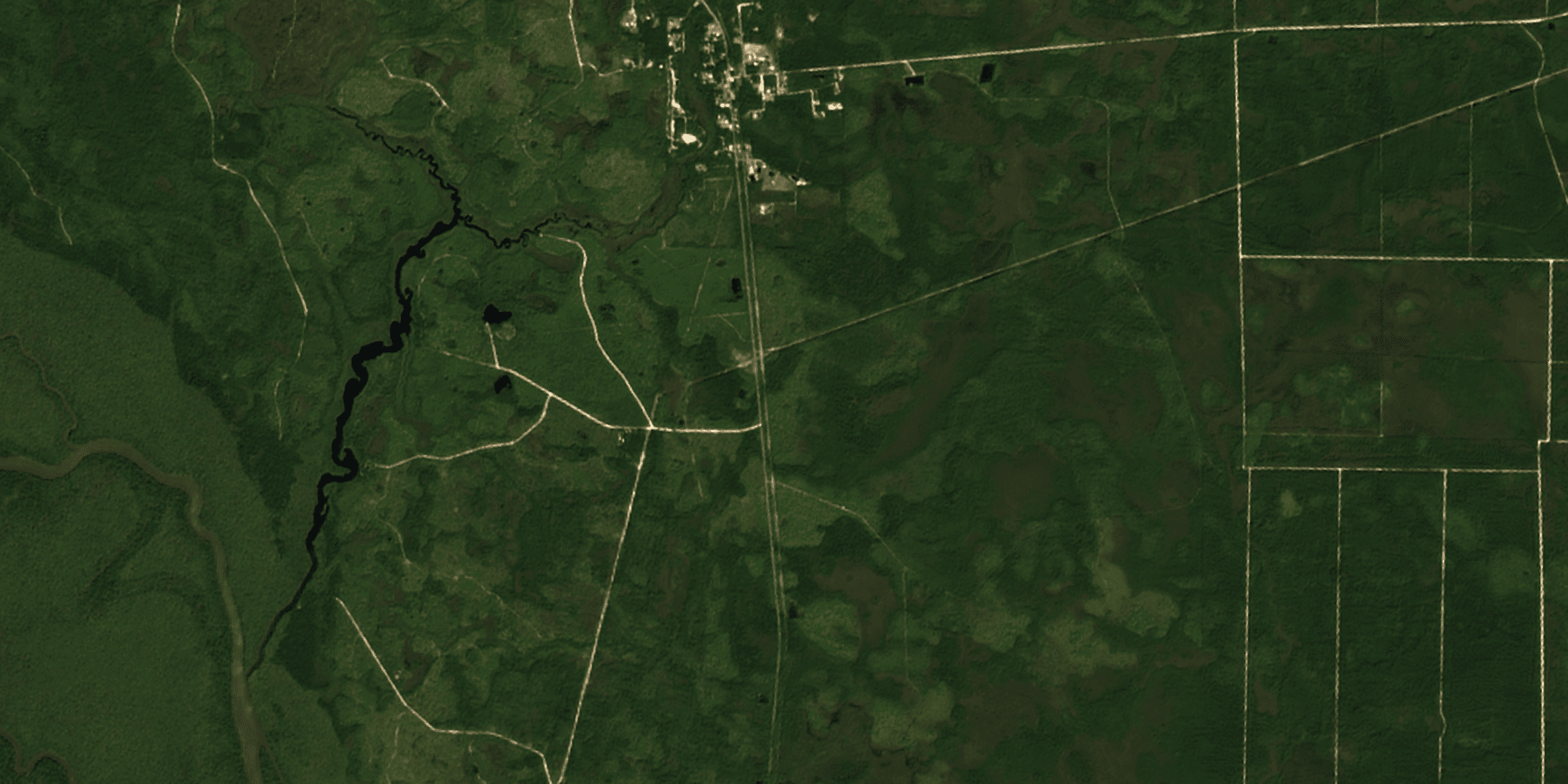
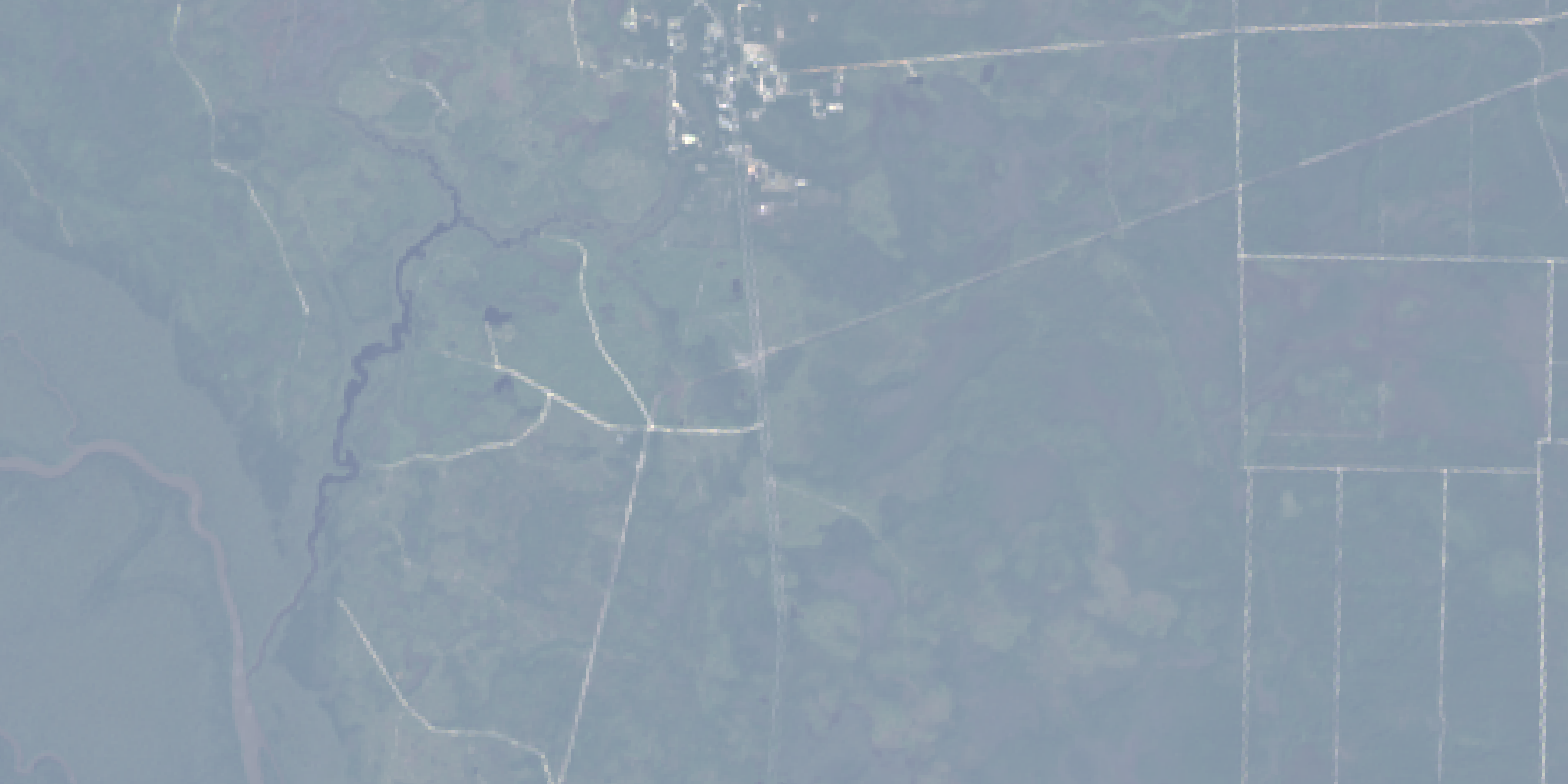
A close-up comparison of Landsat Level-1 and our harmonized Sentinel-2 L2A to see the upsampling effect.
Applications
Use one working format across historical and current analysis
Harmonization is most useful where sensor changes would otherwise interrupt a long-running monitoring or analytics workflow.
Long-term land change
Extend Sentinel-2-style analysis across the Landsat archive for land-use monitoring and change detection over decades.
Agriculture and climate monitoring
Use a consistent multispectral layout for workflows that depend on comparable time series rather than sensor-specific adaptations.
Legacy archive integration
Bring historical Landsat observations into existing Sentinel-2 pipelines, band conventions, and delivery workflows.
Commercial & delivery contract
Data specifications
Ten spectral bands in a consistent 10-metre Sentinel-2-compatible layout, ready for existing multispectral workflows.
The output is ten spectral bands which are in the same 10-meter resolution meaning Sentinel-2 bands in 20-meter resolution bands have been upsampled during the deep learning harmonization process. All spectral bands are in the same order and have the same band names as the Sentinel-2 MSI Instrument (ie. true color is [B4,B3,B2]).
| Band | Wavelength (nm) | Resolution (m) | Description |
|---|---|---|---|
| B2 | 443 | 10 | Blue |
| B3 | 490 | 10 | Green |
| B4 | 560 | 10 | Red |
| B5 | 665 | 10 | Red-edge 1 |
| B6 | 705 | 10 | Red-edge 2 |
| B7 | 740 | 10 | Red-edge 3 |
| B8 | 783 | 10 | NIR |
| B8a | 842 | 10 | Narrow NIR |
| B11 | 865 | 10 | SWIR 1 |
| B12 | 1610 | 10 | SWIR 2 |
The cloudless data has been corrected with Sen2Cor for bottom-of-atmosphere disturbance beforehand. Furthermore, all of our Sentinel-2 data is harmonized to the pre-January 25. baseline. This is to allow for more efficient time-series analysis across multiple years.
For broad repeat monitoring, Grid Monitoring uses whole ClearSKY grid blocks, including our standard 2,621 km² full-tile size. The imagery is projected in UTM and saved in GEOTIFF as INT16. You can read more in our docs.
Common questions
Harmonization FAQ
The practical distinctions to settle before scoping a historical archive.
Is harmonization the same as multi-sensor data fusion?
What band layout and resolution are delivered?
How are Sentinel-2 red-edge bands handled when Landsat does not contain them?
How is the harmonized archive packaged?
Extend your time series
Bring historical Landsat data into your Sentinel-2 workflow
Tell us the archive, geography and delivery format you need. We can help scope a harmonized dataset that fits your existing analysis pipeline.