Build compatible, quality-scored satellite data products
ClearSKY builds production EO pipelines that turn multi-sensor satellite data into reliable, scalable and analysis-ready products — including data fusion, sensor harmonization, usability masks, QA layers and delivery integrations.
From fragmented satellite inputs to usable EO products
Satellite data is increasingly fragmented across sensors, resolutions, formats, archives and quality levels. ClearSKY helps operators, platforms and distributors turn that complexity into products customers can actually use: compatible, quality-scored, analysis-ready and delivered at scale.
Production EO infrastructure
We focus on reusable pipelines, metadata, QA, delivery formats and automation — not isolated proof-of-concept processing.
Quality visible by design
ClearSKY products can include usability probabilities, evidence layers and scene-level summaries so customers understand what they can trust.
Built around integration
Bands, cadence, AOI logic, delivery method, QA layers and downstream formats can be configured around your product and customers.
Capabilities you can combine
Use one ClearSKY capability or combine several into a production pipeline for your sensor, archive, platform or customer-facing EO product.
Custom data fusion
- Fuse optical, SAR and other EO sources into consistent imagery
- Reduce cloud-driven gaps in monitoring and delivery workflows
- Adapt ClearSKY’s fusion stack to new sensors, AOIs and cadences
Sensor harmonization
- Translate imagery into Sentinel-2-compatible formats
- Align spatial resolution, band layout and radiometry
- Create estimated bands where sensors differ or bands are missing
Usability and QA masks
- Add per-pixel usability probability as a first-class data layer
- Help customers understand quality, uncertainty and evidence
- Support filtering, weighting, mosaicking and automated ordering
Analysis-ready products
- Package imagery with metadata, masks and derived layers
- Generate indices, change layers and customer-specific outputs
- Deliver products that fit existing EO analytics workflows
Scalable delivery
- Deliver through GeoTIFF, COG, STAC, APIs or object storage
- Expose platform-native QA fields and catalog metadata
- Build repeatable production pipelines instead of one-off demos
Platform integration
- Embed ClearSKY outputs into existing EO platforms and catalogs
- Expose usable-pixel fractions, quality scores and product metadata
- Support satellite operators adding premium QA to their data products
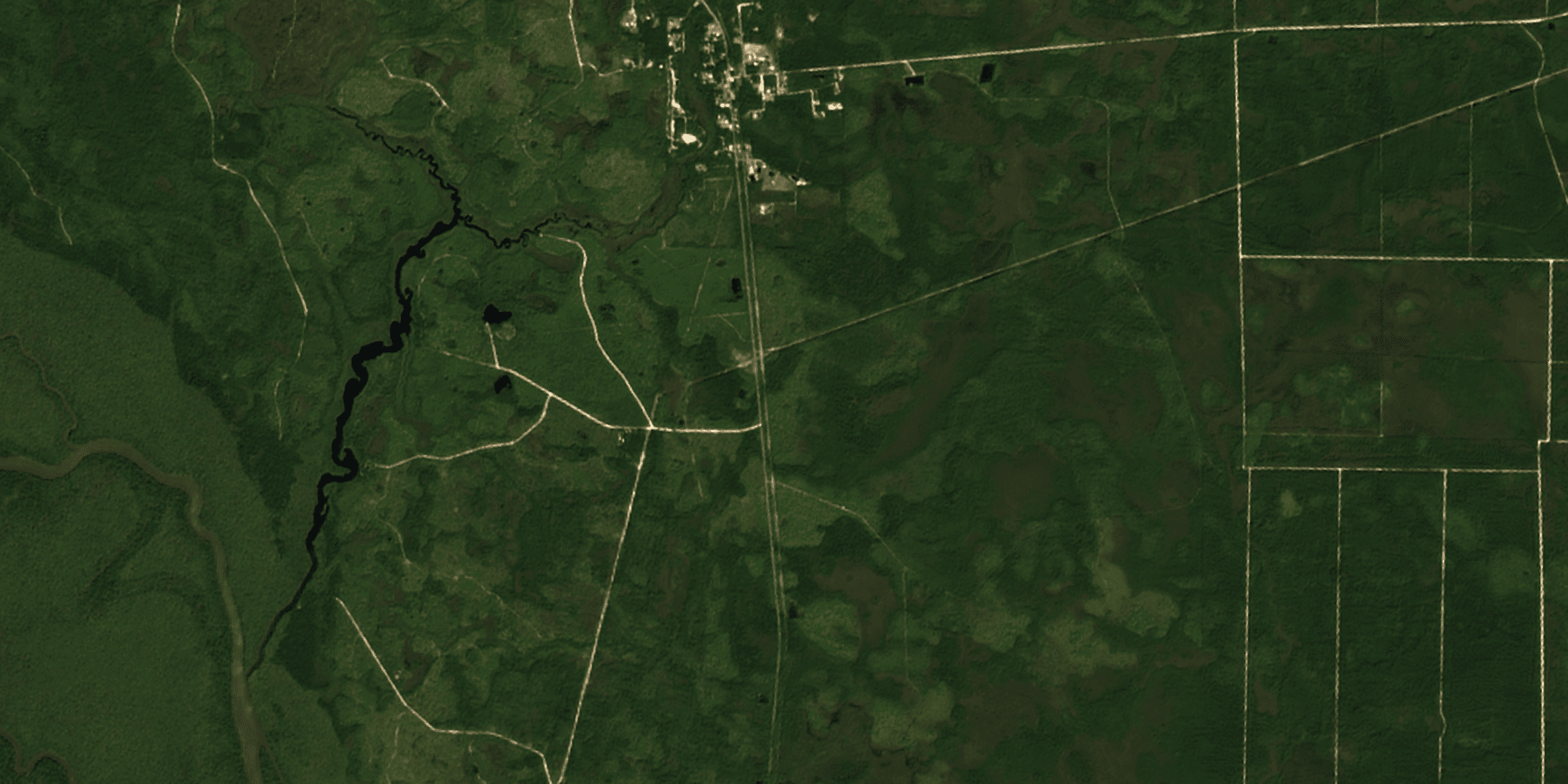
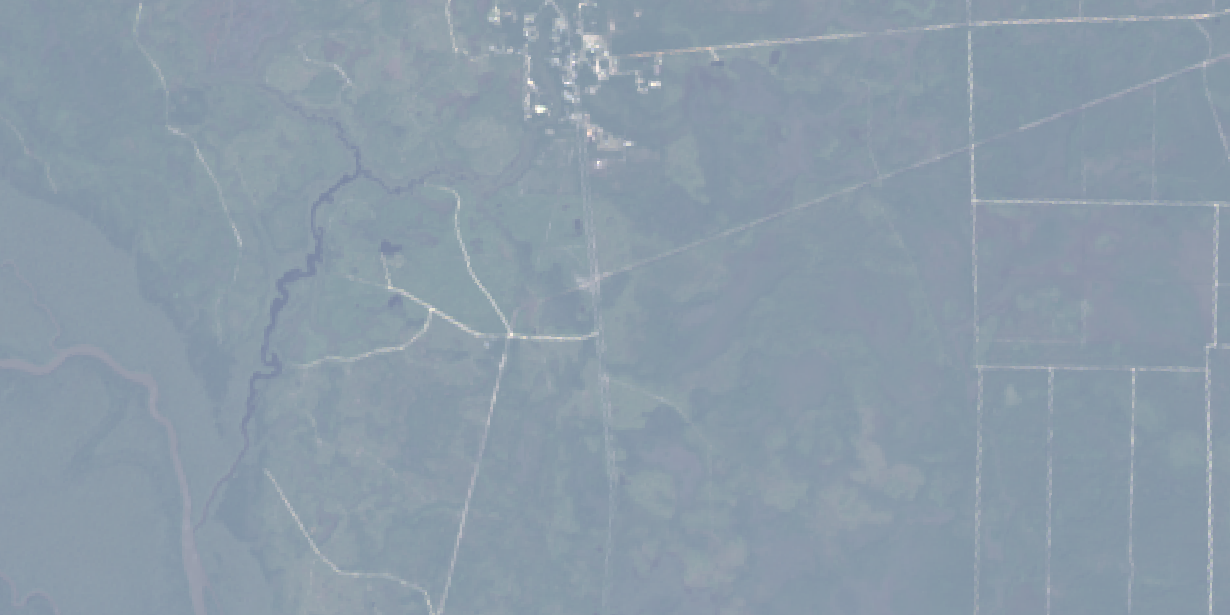
Example capability: Landsat imagery harmonized into a Sentinel-2-compatible output for consistent downstream usage.
Built for operators, distributors and EO platforms
ClearSKY can work behind the scenes as infrastructure, inside your platform as an embedded data product, or directly as a managed EO service.
Satellite operators
- Add usability, cloud and quality signals to new sensor products
- Translate proprietary imagery into customer-friendly EO formats
- Reduce support burden by showing which pixels are reliable
EO platforms and data distributors
- Improve catalog search with usable-pixel metadata
- Offer harmonized and fused products through existing APIs
- Let users filter, rank and order imagery by actual usability
Analytics and product teams
- Build cleaner time series across sensors, seasons and regions
- Use QA layers before vegetation, change or compliance workflows
- Avoid brittle pipelines built around fixed cloud-mask assumptions
More than custom processing
Many EO projects stop at producing a nice image or a one-off analysis. ClearSKY focuses on reusable production pipelines: compatible data, quality signals, metadata, delivery formats and automation that can scale across regions, sensors and customers.
Sensor-compatible outputs
Usability and evidence layers
Scalable production delivery
Built around downstream workflows
A modular EO production pipeline
Start with your imagery, archive, sensor or customer requirement. We help turn it into a repeatable product pipeline with the right QA, compatibility and delivery model.
1. Ingest & normalize
- Public, commercial or operator-owned imagery
- Projection, resolution, metadata and band mapping
2. Score usability
- Cloud, haze, shadow, artefact and low-quality observations
- Per-pixel usability probability and scene-level summaries
3. Harmonize or fuse
- Translate sensors into compatible output formats
- Fuse multi-sensor evidence into cleaner time series
4. Package for production
- COG, GeoTIFF, STAC, API or platform-native delivery
- QA metadata, documentation and integration support
Use ClearSKY directly or embed our capabilities
ClearSKY can support a standard data product, a custom pipeline, or a capability embedded inside your own satellite data platform.
As a managed ClearSKY product
Use ClearSKY’s cloud-free Sentinel-2-compatible imagery, harmonized archives or QA products directly in your platform.
As an embedded capability
Integrate usability masks, harmonization or fusion outputs into your own catalog, dashboard, API or ordering workflow.
As a custom production pipeline
Build a dedicated processing chain for your sensor, archive, customer product or downstream analytics workflow.
Good fit when you need to make EO data easier to trust, sell or scale
ClearSKY is strongest when satellite data needs to become a product: compatible across sensors, clear enough for downstream use, documented with quality signals and delivered in formats customers or platforms already understand.
That can mean adding usability masks to operator data, building a harmonized archive for a distributor, extending an EO platform with cloud-free imagery, or creating a custom fusion pipeline for a high-value monitoring workflow.
ClearSKY can help when:
You operate or distribute satellite data and want to add stronger QA, compatibility or derived products.
Your users need to search, filter or order imagery based on usable pixels instead of basic scene-level cloud percentages.
Different customers need different quality thresholds, formats, bands, cadences or delivery methods.
You need to make data from multiple sensors behave like one consistent, analysis-ready product.
Need a satellite data product customers can actually use?
Tell us your sensors, target customers, quality requirements and delivery format — we’ll help design a scalable EO product pipeline.