50 words
ClearSKY Vision makes Earth observation dependable. We deliver cloud-free, analysis-ready imagery for agriculture and environment that stays consistent across sensors and time. Our AI removes clouds, harmonizes multi-sensor data, and reduces the cleanup work that slows GIS and analytics teams. Build once, scale monitoring across regions and seasons with confidence.
100 words
ClearSKY Vision is building the compatibility layer for Earth observation. We turn fragmented satellite inputs into cloud-free, analysis-ready imagery that stays consistent across sensors and time. Our cloud removal and data fusion reduce manual cleaning, quality control, and harmonization, so GIS and analytics teams can focus on monitoring and decisions, not preprocessing. ClearSKY supports agriculture, forestry, and environmental applications, including crop and vegetation tracking, land cover change, and compliance workflows. Headquartered in Aalborg, Denmark, ClearSKY serves public agencies, agribusinesses, and researchers across Europe. Teams integrate ClearSKY through downloads or API workflows and build once for long-term operations. Media contact: info@clearsky.vision.
200 words
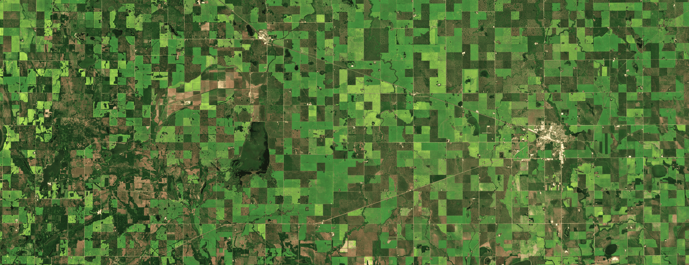
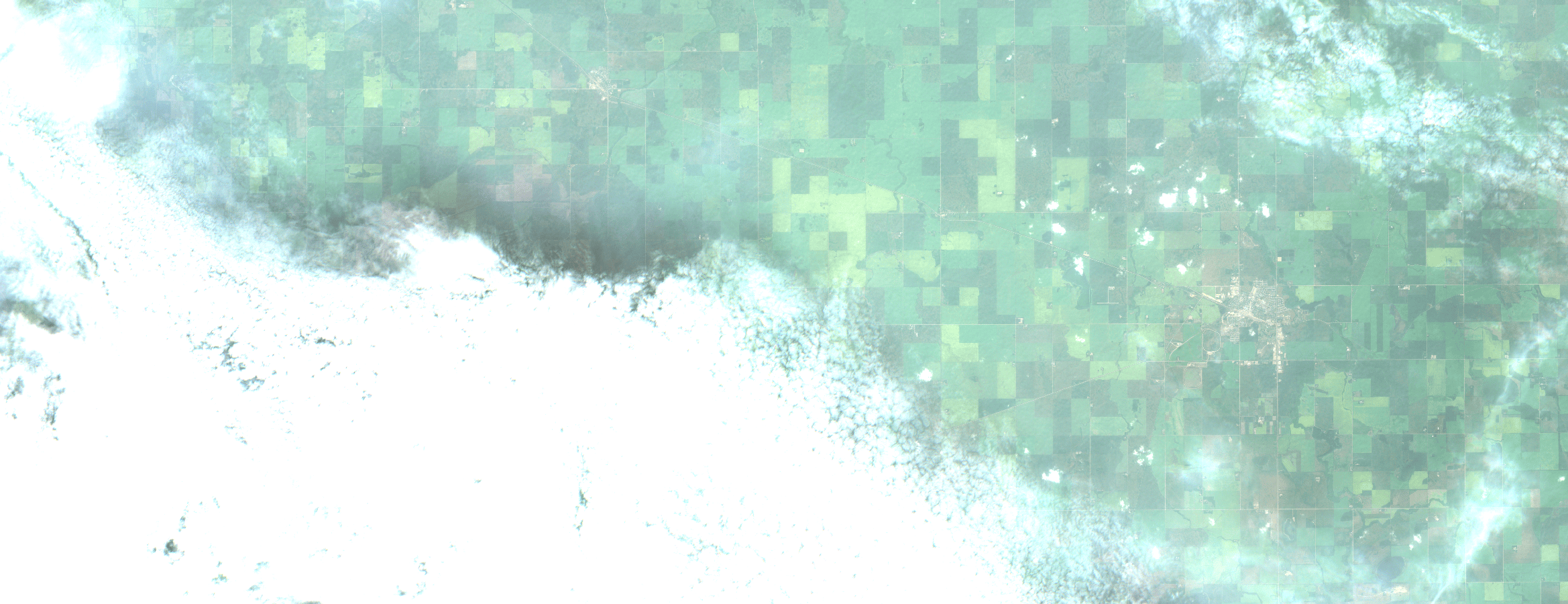
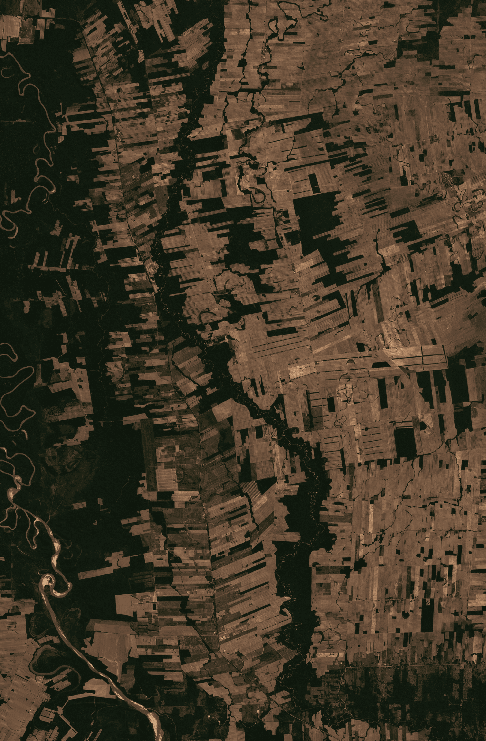
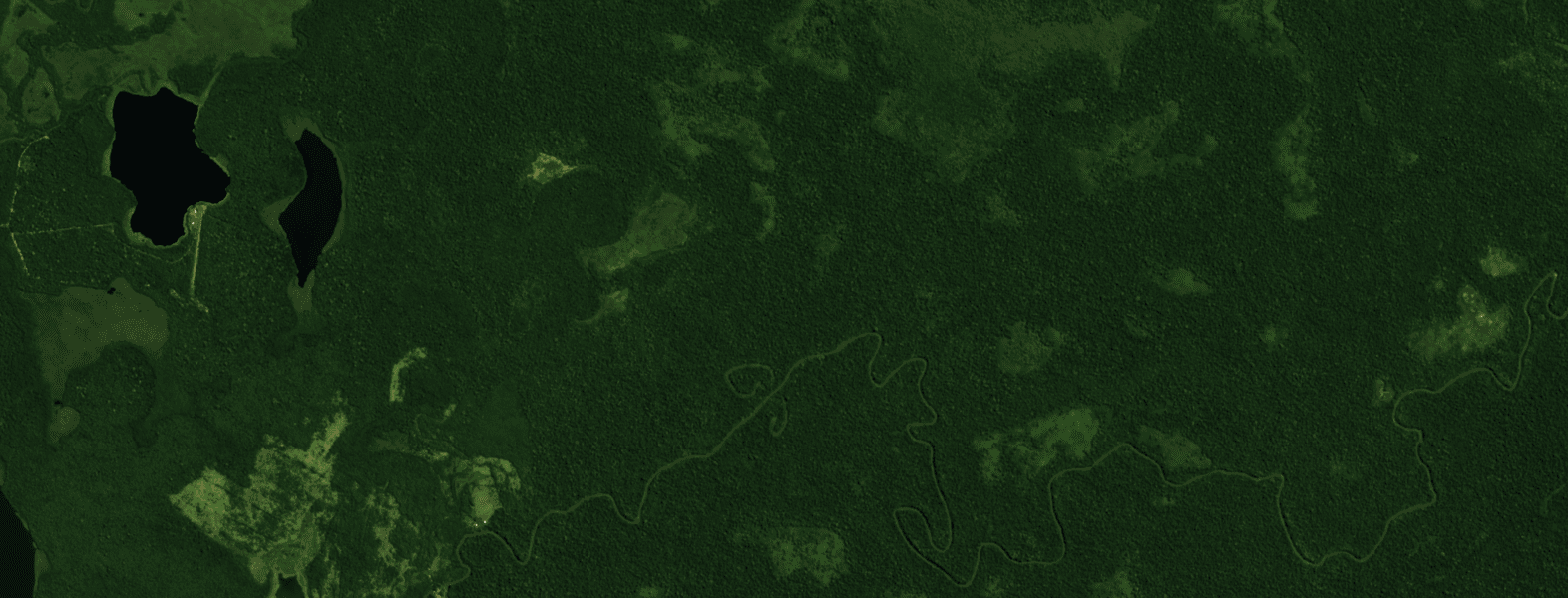
Earth observation is powerful, but the ecosystem is fragmented. Satellites differ, formats vary, clouds break coverage, and missions evolve. Downstream teams often spend more time cleaning, validating, and harmonizing imagery than using it. ClearSKY Vision is fixing that. We build cloud-free, analysis-ready imagery that stays consistent across sensors and time, so automated GIS and analytics pipelines can run reliably season after season. Our AI removes clouds and reconstructs usable pixels by fusing complementary observations, then applies quality control to keep outputs dependable for monitoring. ClearSKY makes Earth observation interoperable. We align sensors so outputs behave predictably, even as source missions change. This reduces integration risk for product teams and data platforms, and shortens the path from raw imagery to insights in production dashboards and models. ClearSKY serves agriculture, forestry, and environmental programs, where cadence matters and gaps create blind spots. Organizations use ClearSKY to track vegetation and land cover change, support compliance and reporting, and scale monitoring across regions without rebuilding workflows for every new dataset. Headquartered in Aalborg, Denmark, ClearSKY works with public agencies, agribusinesses, and research teams across Europe. The company’s flagship service, Cloudless Sentinel-2, delivers consistent time series for decision support and operational monitoring. Media contact: info@clearsky.vision.