Cloud-Free Forestry Monitoring
Wall‑to‑wall, cloudless views to plan, verify, and report felling, thinning, and replanting.
Trusted by leading organizations
The Cloudy Challenge
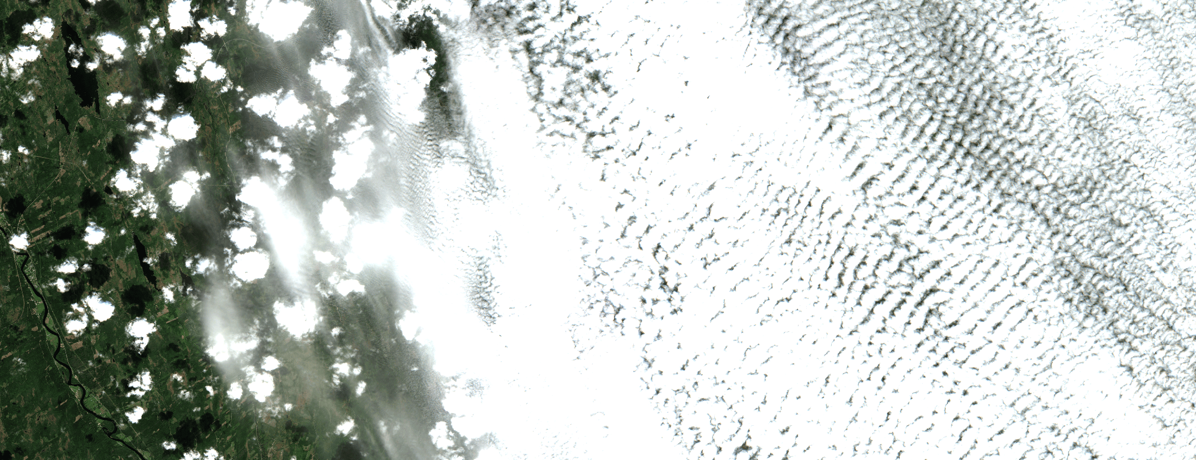
Harvest windows are tight and permits require documentation. Dense cloud cover disrupts compartment‑level monitoring, masks skid trails, and blurs where thinning or clear‑fell occurred. Without a complete time‑series, compliance checks stall and stakeholder reporting suffers. Managers need dependable, cloud‑free mosaics to confirm operations, verify replanting, and detect unplanned activity across large estates.
- Persistent cloud cover
- Broken / delayed time-series
- Weak audit evidence
Our Solution
ClearSKY fuses optical and SAR satellites using artificial intelligence to reconstruct complete, Sentinel-2 compatible images. You get cloud-free, analysis-ready data via dashboard or API, so you can focus on decisions, not cloud, shadows and image gaps. Confirm felling areas, validate replanting, and share clear audit evidence with regulators and stakeholders.
- Compartment‑level clarity
- Faster change detection
- Audit‑ready from the start
Clouds out, decisions in!
Consistent, frequent, gap-free views for grand-scale monitoring.
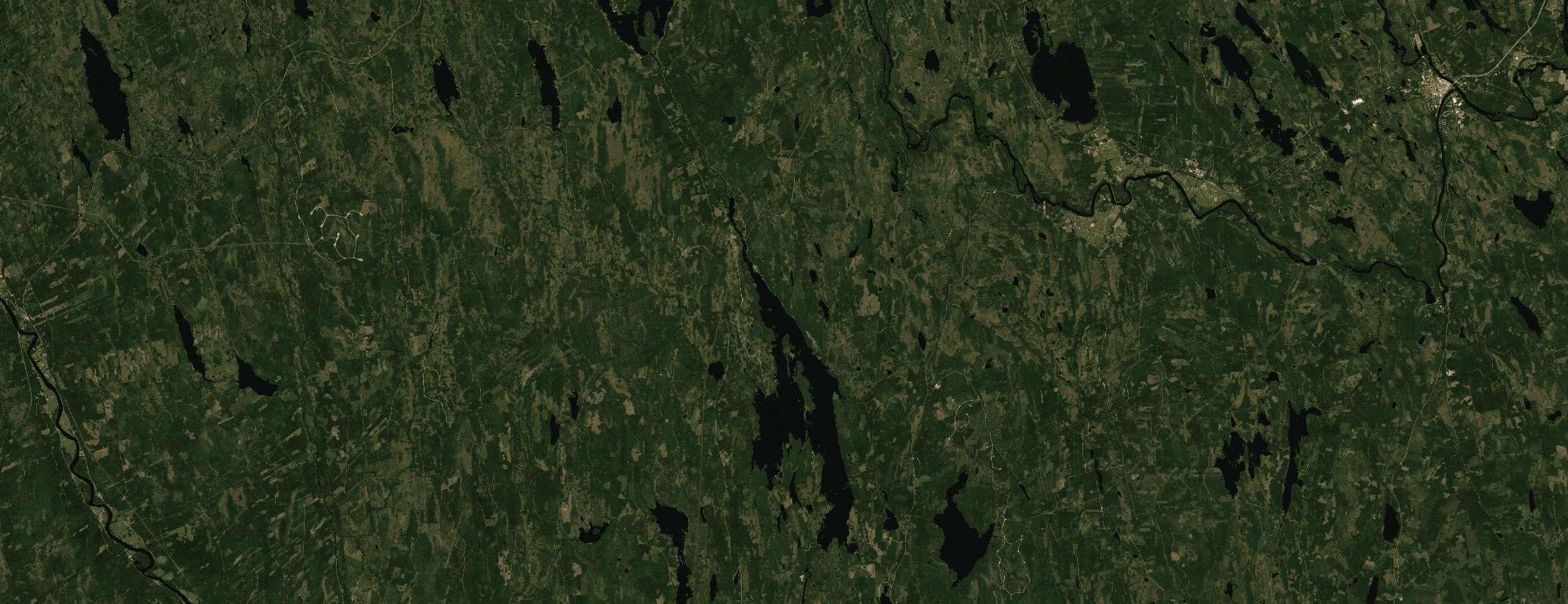
Vansbro, Sweden · Aug 2025 · 10 m bands (S2-compatible)
How it works
Fuse
We combine optical + SAR and other sensors to remove clouds, shadows and gaps.
Deliver
Get Sentinel-2 compatible tiles or composites through API or dashboard.
Analyze
Use analysis-ready pixels immediately. No masking or stitching required.
Why ClearSKY for Forestry
AI-Powered Fusion
Combine optical & SAR for cloud-free mosaics.
Reliable Cadence
Daily to weekly updates.
Fits Your Workflow
Tiles, composites, API, or dashboard.
Analysis Ready
No masking or gap-filling needed.
Enterprise Support
Stable service with responsive help.
Scales Globally
From small plots to regions.
Start with a free trial
Explore cloud-free, analysis-ready imagery in our dashboard. Switch to the API when you’re ready.