Case Study
Efficiency & ROI
How ClearSKY’s analysis-ready imagery can save time and reduce operational cost at scale.
The Traditional Workflow
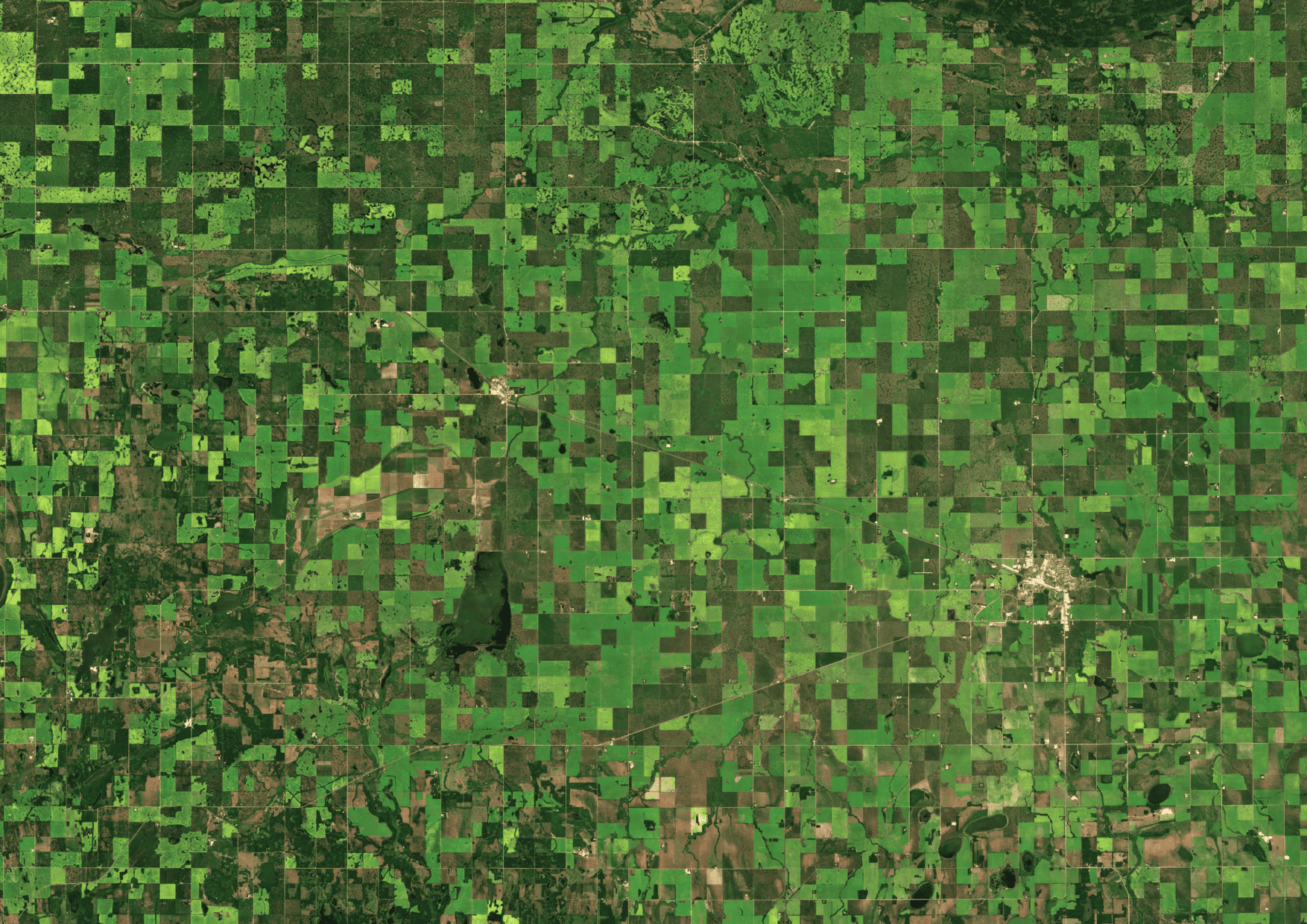
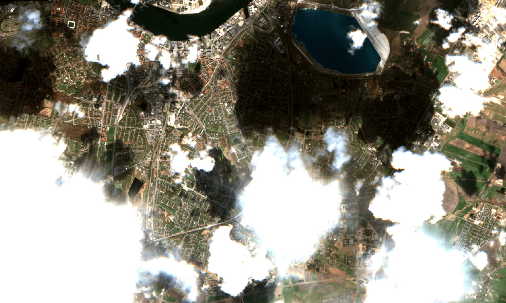
Many large-scale satellite projects juggle multiple data streams, each with different APIs, formats, cloud masks, projections, and band definitions. Teams often spend significant time on cloud and shadow handling, reprojection, mosaics, tiling, metadata alignment, and quality checks before any analysis can begin.
This effort typically scales with project size. As coverage grows from farms to regions and countries, integration and preprocessing become a recurring cost that slows monitoring and makes automation harder.
Our Analysis-Ready Data
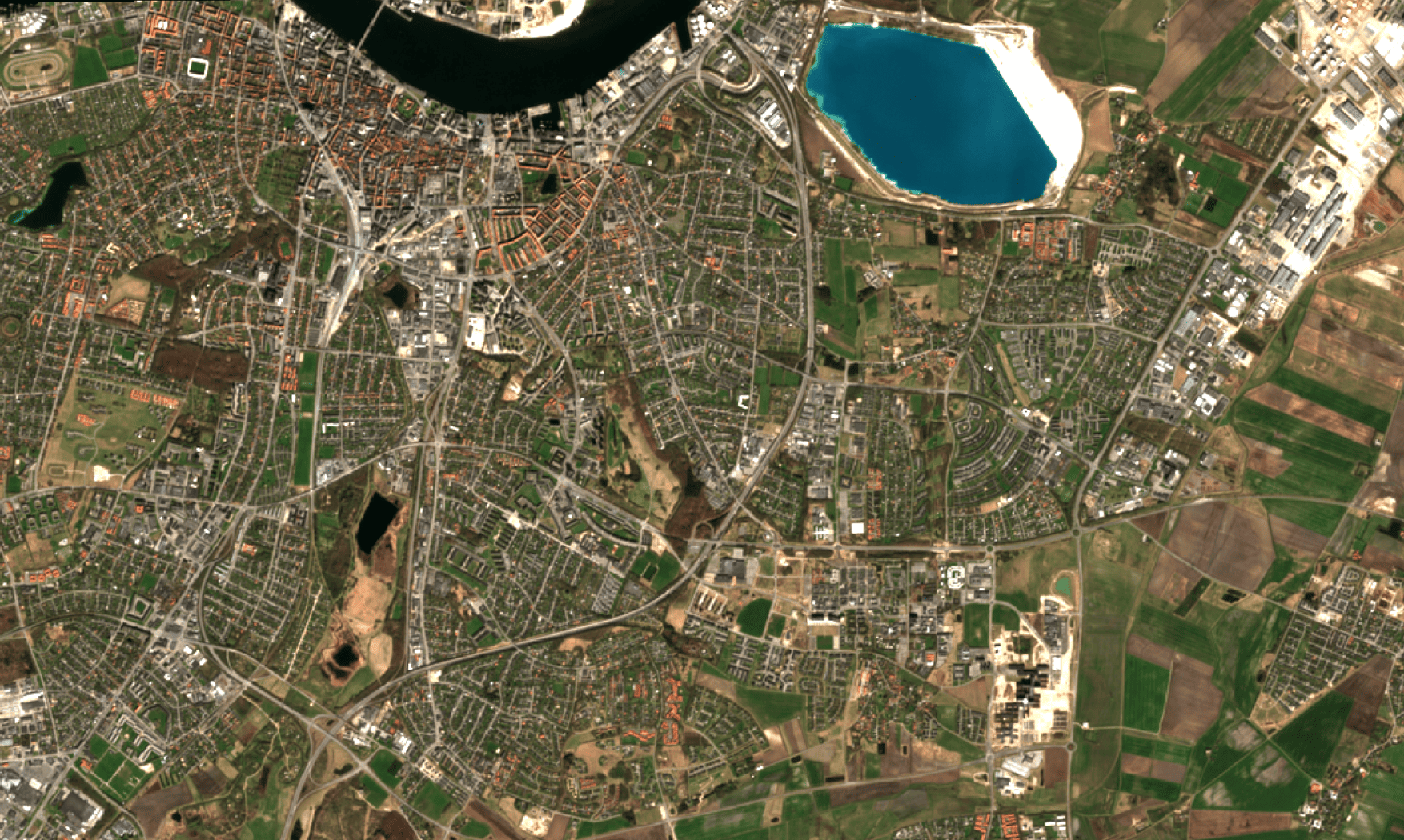
ClearSKY delivers cloud-free, analysis-ready imagery designed for downstream GIS and analytics. The goal is simple: reduce manual preprocessing and make satellite inputs dependable in production workflows.
Instead of managing intermediate files and stitching pipelines together, teams can integrate one consistent output and spend time on monitoring and decisions.
Transparent Savings & ROI
Plug in your numbers to estimate savings per project and across a year. This is meant as a quick sanity check for internal planning and business cases.
This calculator is for illustrative purposes. Adjust inputs to match your team and project scale.
Key Takeaways
Want a tailored estimate for your workflow, geography, and cadence requirements?
Contact us